Where the Idea Came From
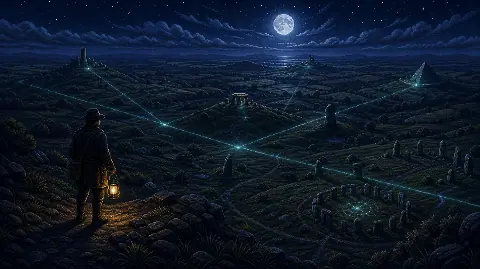
Watkins presented his straight-track proposal to the Woolhope Naturalists’ Field Club in 1921. His 1922 book Early British Trackways described sighting routes across the British landscape, using prominent features as markers. This was a claim about how people travelled and found their way.
He developed the argument in The Old Straight Track, first published in 1925. Finding a line was only part of his method. He also looked for physical traces and interpreted place names as clues to lost routes. These books document his proposal; their age does not make that proposal an established archaeological finding.
A different interpretation grew during the 1960s revival. Archaeologists Tom Williamson and Liz Bellamy’s 1983 examination of ley theory traces the shift towards supposed earth-energy currents, including the influence of John Michell. The modern energy claim should therefore be distinguished from Watkins’s original transport hypothesis.
The spelling also separates two unrelated subjects. A sailing layline describes a course from which a boat can reach a mark without another tack or gybe. It is not a ley line connecting ancient sites.
Three Claims That Need Different Evidence
| Claim | What Can Be Checked | What a Line Alone Cannot Show |
|---|---|---|
| Sites line up | Coordinates, map projection and distance from the proposed line. | Whether the pattern is unusual among all eligible sites. |
| People planned a route | Construction dates, excavated tracks and evidence linking the places. | That builders separated by centuries shared a plan. |
| The route carries energy | A defined physical quantity measured repeatedly with suitable controls. | The existence, source or effects of that energy. |
Williamson and Bellamy describe a recurring historical difficulty. Watkins included later features, such as medieval churches, by proposing continuity with much older sites. That continuity needs evidence at each location. The existence of an old church does not, by itself, date the use of its site to the Neolithic.
Why a Convincing Map Can Mislead
Showing only the places that fit removes the context needed to judge an alignment. The two panels below use the same invented positions. The first displays four selected points; the second restores all 24. No point has moved.
Four Selected Points
Most of the available positions are hidden.
All 24 Points
The highlighted alignment remains, alongside the omitted positions.
Chance alignments are a statistical question. David and Wilfrid Kendall’s 1980 research on random point sets examines how to test for an excess of near-alignments, including the allowed tolerance. A visual impression alone cannot supply that comparison.
A thicker line admits more near-misses. Adding churches, wells, hilltops and modern landmarks also enlarges the pool of possible matches. If those rules change after an attractive pattern appears, the result needs to be tested with the expanded rules, including the unsuccessful searches.
Stonehenge Shows What a Documented Alignment Looks Like
Stonehenge has a solstice orientation that can be checked against the monument and the Sun. English Heritage describes midsummer sunrise behind the Heel Stone to the north-east and midwinter sunset to the south-west.
That is a specific relationship between a structure and an observable celestial event. It does not establish a line of power connecting unrelated monuments. Assessing a claimed network requires additional evidence for the links between its sites, even where individual monuments have genuine astronomical orientations.
How to Check a Ley-Line Map
Record the rules before drawing or extending a line. These checks make a claim inspectable and help reveal where the conclusion depends on choices made by the map’s creator.
- Define the area and eligible sites. List every site meeting the criteria, including those away from the proposed line. Do not add a new category just to obtain another match.
- Use precise locations. Record coordinates and whether each point means a doorway, a stone, a summit or the centre of a large complex. State the map projection and measurement method.
- Set a tolerance. Say how far a site may sit from the line and still count. A line drawn across an entire hill is a different claim from one passing through a particular stone.
- Check the chronology. Look for archaeological records establishing when each feature existed. If a later building supposedly replaced an earlier marker, find evidence for that earlier use.
- Compare with alternatives. Test the same rules on other lines or suitable simulated datasets. The comparison should account for site density, clustering and how many candidate lines were searched.
- Publish the misses too. Share the full site list, exclusions and results so another person can repeat the analysis without guessing your decisions.
These checks can assess a geographical pattern. They cannot, on their own, identify a builder’s intention or a physical energy mechanism. Our examination of the 30th parallel and UFO hotspot claim applies the same distinction between a mapped pattern and an explanation for it.
Are Ley Lines Magnetic or Spiritual?
Earth’s magnetic field is real and measurable. NOAA explains how its direction and intensity are recorded, with field strength commonly reported in nanotesla. Those measurements do not turn a line joining landmarks into a magnetic channel.
A claim of unusual magnetism needs measurements along the proposed route, comparable locations away from it, instrument checks and repeat observations. Calling an experience “energy” does not specify a physical quantity that can be tested.
A place may still have personal, spiritual or cultural significance. That experience is different from demonstrating an ancient network or a new force. When visiting, use the site’s own archaeological information to understand its history, and treat a ley-line overlay as an interpretation to examine.