Where Is Kirvi?
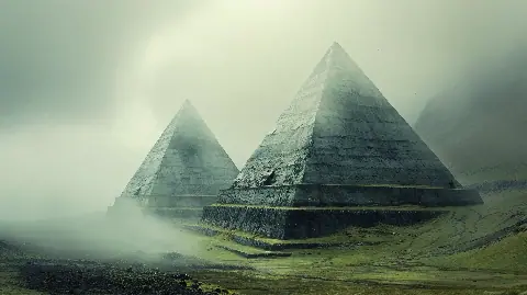
Kirvi is a mountain on the island of Suðuroy in the southern Faroe Islands. Photographs taken across the water can emphasise its triangular outline and horizontal steps, leading to labels such as the Faroe pyramid.
The name describes appearance, not an archaeological classification. There is no recognised excavation or monument record identifying the mountain as a built structure.
How The Faroe Islands Formed
The islands are remnants of a large Paleogene volcanic province created by repeated basalt eruptions roughly 60 million years ago as the North Atlantic opened. Successive lava flows produced stacked rock units separated in places by softer sediments and weathered surfaces.
The Geological Survey of Denmark and Greenland outline of Faroe geology documents the basalt succession, volcanic evolution, intrusions, sediments and later landscape development.
Why The Mountain Looks Stepped
Hard basalt layers resist erosion better than softer material between flows. Weathering therefore creates benches and cliffs that can resemble courses of masonry at landscape scale.
Glaciers, streams, frost and marine erosion then cut valleys and steep slopes through the layered plateau. Where erosion approaches a ridge from several directions, the remaining mountain can take a pointed or pyramid-like form.
Natural Feature Or Monument?
| Test | Natural mountain expectation | Constructed pyramid expectation |
|---|---|---|
| Layer continuity | Basalt beds continue into surrounding landscape | Courses terminate at designed faces or core |
| Material | Local lava flows and sediment units | Quarried or deliberately placed blocks |
| Surface | Irregular erosion, scree and vegetation | Worked faces, joins, access or retaining structures |
| Cultural evidence | No requirement for artefacts | Tools, occupation, dating and construction sequence |
Kirvi fits the first column. Horizontal lines alone do not demonstrate masonry when the region is already built from horizontal lava units.
How The Claim Spread
Social posts often pair one distant photograph with statements that the faces are too regular to be natural. Some add ley-line alignments or global pyramid networks without publishing coordinates, measurements or geological sampling.
An AFP fact check of pyramid-shaped natural formations shows how similar images are repeatedly detached from their geological setting. The visual comparison is worth explaining, but repetition does not create archaeological evidence.
Could Future Evidence Change The Conclusion?
Any location can be investigated further. A serious construction proposal would map the rock units, show features inconsistent with natural bedding, document worked surfaces and establish a cultural and chronological context.
Until such evidence exists, the geological explanation accounts for both the material and the form without an unknown builder.
Related Evidence Files
Use the LIDAR methods guide to see how shapes become archaeological claims. Compare Kirvi with the genuine monument sequence in the Pyramid of Huni investigation and the pattern tests in the Giza Orion alignment.
Sources And Further Reading
- GEUS Bulletin: Geology of the Faroe Islands
- Jarðfeingi, the Faroese Geological Survey
- AFP: Fact checking pyramid-shaped mountains
FAQs
Is Kirvi A Man-Made Pyramid?
No archaeological evidence currently identifies it as constructed. Its form follows the layered basalt geology of Suðuroy.
Why Does It Have Horizontal Steps?
Successive lava flows and softer interbeds weather at different rates, creating repeated cliffs and benches.
Has Kirvi Been Excavated As A Monument?
No recognised archaeological project has documented a constructed core, worked blocks or a cultural building sequence.